WaterSENSE
The world faces a rapid and unprecedented change in water availability during the current century1. The past few decades have shown that current climate change is resulting in more frequent extreme weather, with excessive floods and droughts2 and, more importantly, shifts of climate zones. These, in turn, are leading to historically favourable locations for agriculture sometimes being transformed into devastatingly dry areas.
Meanwhile, global population increase is resulting in vulnerable water resources becoming depleted in many locations.
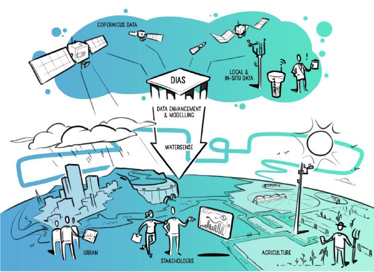
WaterSENSE will deliver essential value-added services of monitoring compliance of local water use against water rights and regulations: water auditing. The first application is in the multi-climate Murray-Darling Basin in Australia, followed by validation in South Africa and the Netherlands.
International Consortium Partners
The WaterSENSE consortium consists of 7 partners:
HydroLogic Research (Netherlands), eleaf (Netherlands), Water Technology (Australia), HCP International (Netherlands), The University of Sydney (Australia), HIDROMOD (Portugal) und hydro & meteo GmbH (Germany)
Workpackage hydro & meteo
The main focus of hydro & meteo is on innovative solutions for the interface between hydrology and meteorology, addressing specifically the water industry and other weather-related economic sectors. In workpackage two, hydro & meteo is developing algorithms to quantify the water availibility and in a second task, the water use. The third step will be to research and develop methods to calibrate and validate these algorithms and the WaterSENSE system as a whole.
An H2020 – EU – project
